
Kukebai Fm
Type Locality and Naming
Western Tarim Basin. The Kukebai Formation was erected by the No.107 Geological Team under the Xinjiang Petroleum Administration in 1976. The section for the designation is in Kukebai about 20 km west of Ulugqat of the Wuqia County, Xinjiang.
Lithology and Thickness
The Kukebai Formation is represented by green mudstone with shelly bed and shelly limestone. Its base is built up by variegated mudstone and mudstone with thin-bedded gypsum mudstone and gypsum, with a layer of gray thick-bedded limestone in its lower part serving as a marker bed for regional correlation. It is 124 m thick.
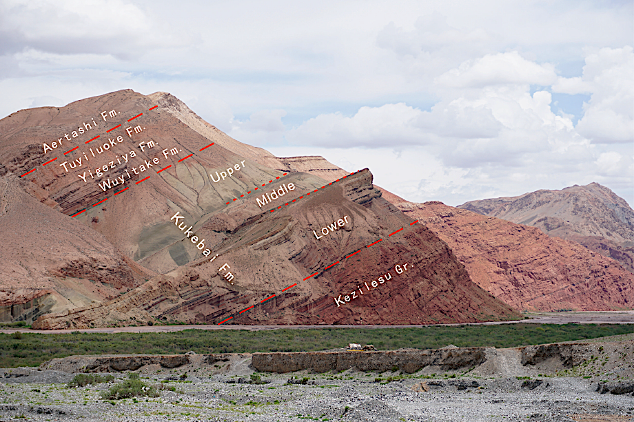
[Figure: Kukebai and relative formations in Arkeceyi section, Akeqi village of Wuqia County, Xinjiang
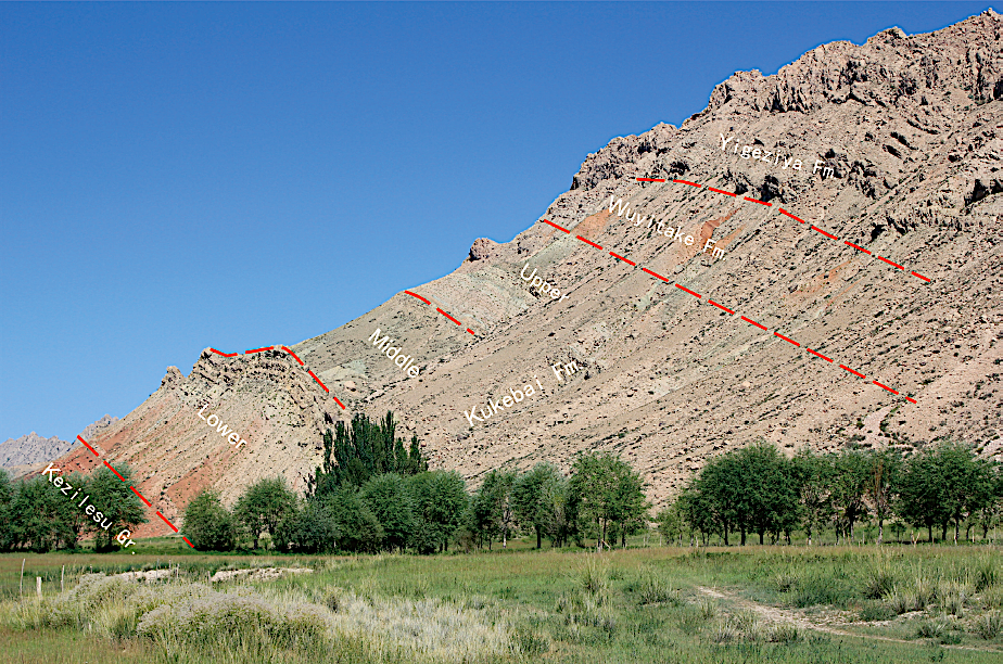
[Figure: Kukebai and relative formations in Simuhana section, 153 km west of Wuqia County, Xinjiang]
Relationships and Distribution
Lower contact
The base of the formation, marked by the appearance of variegated mudstone, is distinguished from gray white massive sandstone of the underlying Kezilesu Gr. The formation shows a conformable contact with the underlying formations.
Upper contact
The top, marked by yellow green limy shelly fine sandstone, is bounded by variegated gypsum mudstone of the overlying Wuyitake Fm. The formation shows a conformable contact with the overlying formations.
Regional extent
The present formation occurs in Ulugqat, Bashibulake, Kukebai, Kuzgongsu and Shaleibier mountains in front of the Tianshan Mountain, and in Yigeziya, Tamu, Qimeigen, Artashi, Shilapu and Moke in front of the Kunlun Mountain. Along the northern foot of the Kunlun Mountain, it decreases in thickness from west to east, and is 85 m thick east of the Yarkant river and thins out in Duwa.
GeoJSON
Fossils
It yields bivalves Ostrea deletrei, O. vatonnia, O. rouvillei, Trigonia jerganensis; gastropods Aporrhais (Helicaulanxig) tarinensis; Ammonites Pacenticeras placenta, Thomasites koulbicus; Foraminifera Gaudrgina fabra, Anomalina sp., Nontou sp., Ammobaculites pressus, A. pocerulum; ostracods Bythocypris acclinis elliptica; Dinoflagellates Cylonephelium vannophorum- Canningia colliveri assemblage; and the palynological assemblage the Nevesisporites radiatus- Triclopites micromunus assemblage.
Age
Depositional setting
The early stage deposition of the formation is lagoon facies while the late stage deposition is neritic facies
Additional Information